$0.00


There’s no two ways about it—Climate TRACE is a game-changer for the climate movement.
Co-founded by Al Gore and Gavin McCormick, Cliomate TRACE uses satellites, remote sensing technology, and artificial intelligence algorithms to monitor emissions from 660 million sources around the world. It’s not just the kind of facilities you’d expect, either—Climate TRACE keeps tabs on everything from wastewater treatment plants and coal-fired power plants to planes and rice paddies.
Its powerful work is rooted in an equally powerful principle: if we want to advance meaningful, strategic climate action, we need to know exactly where emissions are coming from.
So what’s the story behind this incredible resource?
It all started six years ago, when two organizations set out to monitor power plant emissions from space. Former Vice President Al Gore caught wind of the effort and helped support their work, pushing them to think bigger and work with others to expand. The result is what you see today—a database that has grown from 500 emissions sources to over half a million in practically no time at all, and a coalition of more than 100 nonprofits, researchers, universities, and tech companies.
To say that this work is vital is an understatement. Historically, elected officials and scientists have had to rely on out-of-date, incomplete, and self-reported data in policy development and research. Now, thanks to the Climate TRACE team, better, highly-localized data is freely available, supporting the work of groups like these and climate advocates like us.
And their impact doesn’t stop there.
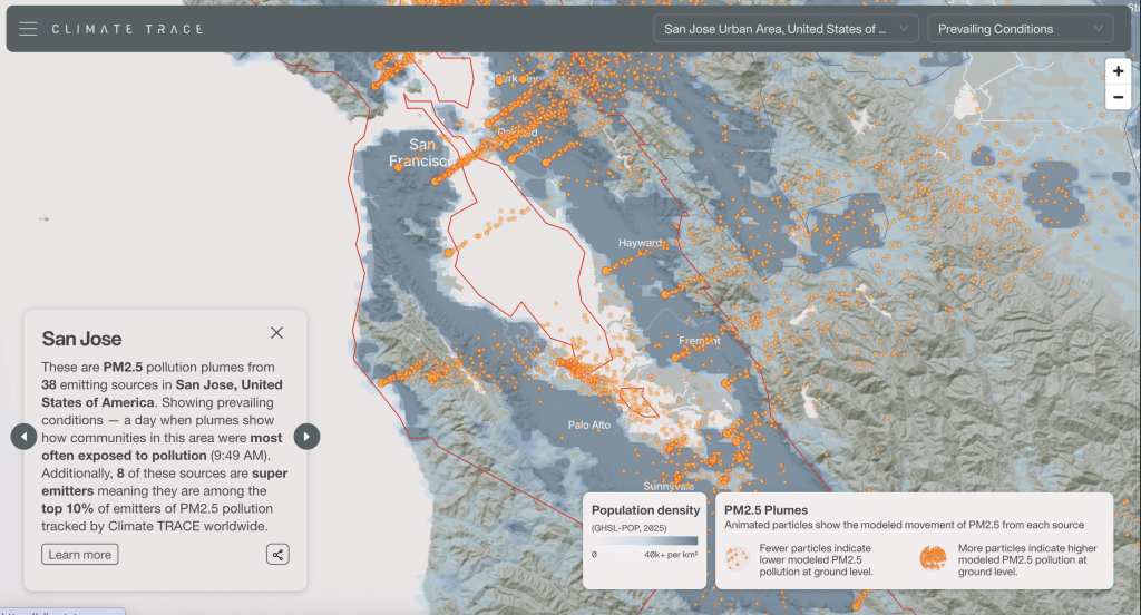
With their new pollution plume visualizer, Climate TRACE is doing one more really important thing—making air pollution the most “visible” it’s ever been.
Even if data tells us that emissions and air pollution are increasing at the state and city levels, it’s typically impossible to see those increases with the naked eye. And when people can’t see a problem, it’s easy to put it on the back-burner, regardless of the very tangible health impacts air pollution is having on communities across the country.
Climate TRACE’s new tool completely changes that.
Now, anyone can search for a major metropolitan area, navigate a user-friendly map, and see emissions from facilities visualized as striking plumes. It’s the clearest picture we’ve ever had of how air pollution travels—and how emissions sources are directly impacting nearby communities.
As one journalist put it, we can finally track the “super polluters next door.”
With Climate TRACE’s new visualizer only just starting to gain traction, we have a major opportunity to help get it in front of as many people as possible.
Join us as we share this powerful resource far and wide!